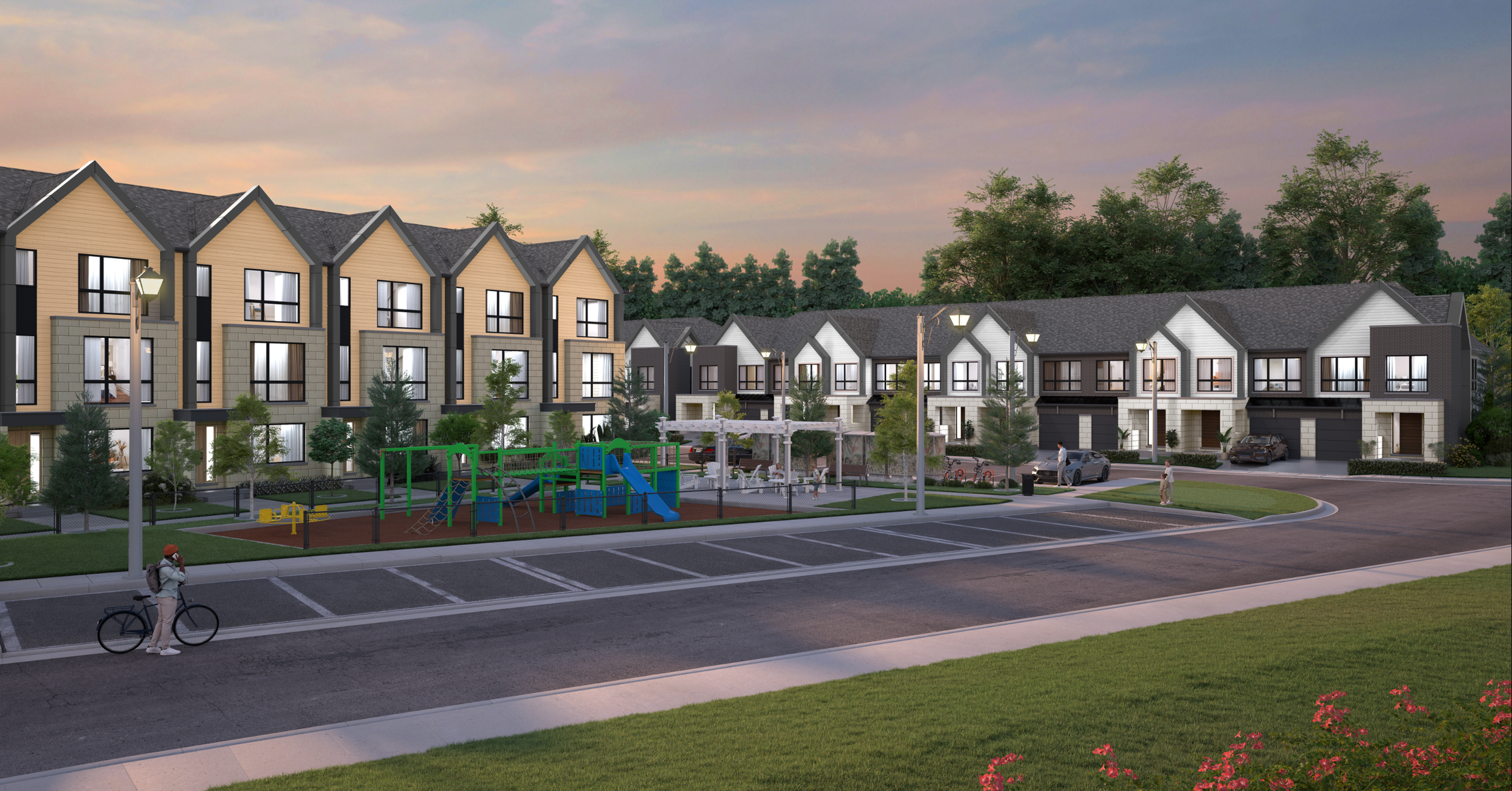
31 Sand Rd is a planned neighborhood in East Gwillimbury that combines residential areas, local commercial spaces, and natural features. The mixed-use plan includes family-oriented housing alongside nearby amenities to provide day-to-day services within walking distance.
The development includes a range of unit types and sizes intended to accommodate different household needs, such as families and professionals. The street network, pedestrian pathways, and trail connections are designed to support walkability and encourage outdoor use.
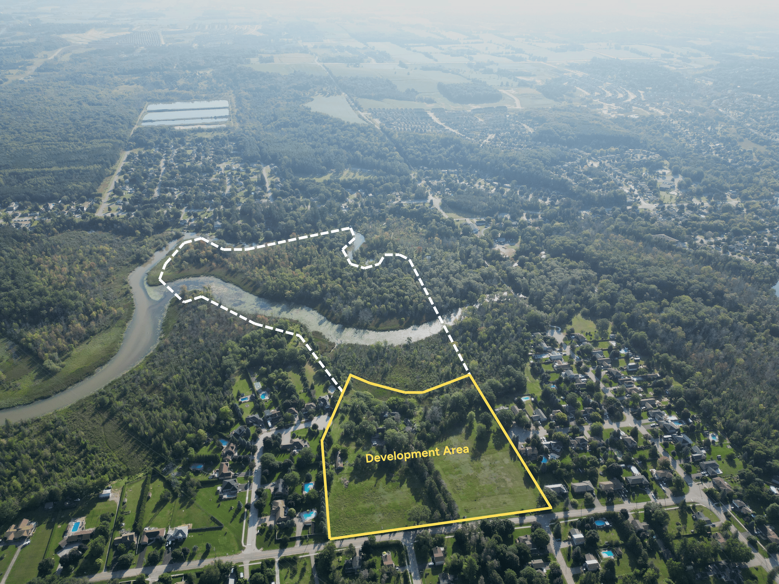
Environmental considerations have been a core part of the planning process. In line with Lake Simcoe Region Conservation Authority and Ministry of Environment standards, more than two years of technical work, including a four-season environmental impact assessment, have informed the design. These studies have guided measures to protect wildlife, maintain green spaces, and preserve the ecological balance of the area.
The project also includes infrastructure and capacity improvements that align with East Gwillimbury’s long-term growth objectives. A proposed natural buffer trail could connect to the Town’s Doane Boardwalk link and extend through Yonge Street to the Nokkida Trail. This would be consistent with the recently approved Yonge Street revitalization and trail extension, contributing to the advancement of the Town’s Transportation Master Plan.
About the 31 sand development project